Space WX Alerts: EXTENDED WARNING:  Geomagnetic K-index of 4 expected ( Latest Alert ) - Issue Time: 2024 Apr 26 2300 UTC
Radar Local Radar (click to enlarge)
41.4°F  95% CBI: -2 Chandler Burning Index Description
41.3°F
Calm
Fire Weather Index icons
Live FWI: 0.6
Fire Weather Index icons
Live FWI10: 0.6
Current Conditions for Foresthill, CA.
Updated4/27/24  2:17am
  Welcome
Current Lightning Map
Current Fire Danger
La Niña / El Niño Index
La Niña El Niño
Very Strong Strong Moderate Weak Neutral Weak Moderate Strong Very Strong
< -2 -2.0 to -1.5 -1.5 to -1.0 -1.0 to -0.5 -0.5 to 0.5 0.5 to 1.0 1.0 to 1.5 1.5 to 2.0 2 >
Synopsis:  A transition from El Niño to ENSO-neutral is likely by April-June 2024 (85% chance), with the odds of La Niña developing by June-August 2024 (60% chance). The next ENSO Diagnostics Discussion is scheduled for May 09, 2024.

Highlights

  • The Oceanic Niño Index (ONI) is NOAA's primary index for tracking the ocean part of ENSO, the El Niño-Southern Oscillation climate pattern.
  • The ONI is the rolling 3-month average temperature anomaly-difference from average-in the surface waters of the east-central tropical Pacific, near the International Dateline.
  • Index values of +0.5 or higher indicate El Niño. Values of -0.5 or lower indicate La Niña.
Your browser does not support HTML5

Data Compliments of National Weather Service


What Does El Niño Mean for Northern California?


What is El Niño?

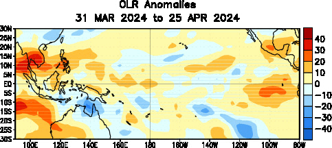
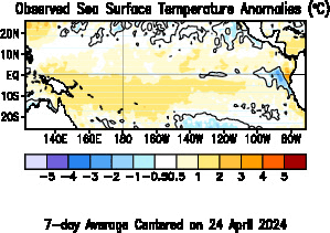
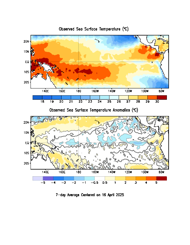
The El Niño Southern Oscillation (ENSO) is made up of both El Niño and La Niña and are periodic departures from expected sea surface temperatures near the equator in the Pacific Ocean. These warmer or cooler than normal ocean temperatures can affect weather patterns around the world by influencing high and low pressure systems, wind, and precipitation. El Niños occur irregularly, approximately every 2 to 7 years. There are three phases to this single climate phenomenon:

  • El Niño:  A warming of the ocean surface, or above-average sea surface temperatures (SST), in the central and eastern tropical Pacific Ocean.  Over Indonesia, rainfall tends to become reduced while rainfall increases over the tropical Pacific Ocean.  The low-level surface winds, which normally blow from east to west along the equator (“easterly winds”), instead weaken or, in some cases, start blowing the other direction (from west to east or “westerly winds”).
  • La Niña:A cooling of the ocean surface, or below-average sea surface temperatures (SST), in the central and eastern tropical Pacific Ocean.  Over Indonesia, rainfall tends to increase while rainfall decreases over the central tropical Pacific Ocean.  The normal easterly winds along the equator become even stronger.
  • Neutral:Neither El Niño or La Niña. Often tropical Pacific SSTs are generally close to average.  However, there are some instances when the ocean can look like it is in an El Niño or La Niña state, but the atmosphere is not playing along (or vice versa). (credit: climate.gov)

What Does El Niño Mean for Northern California?

  • In Northern California, there is little correlation between precipitation and most ENSO patterns. Southern California is generally much more impacted with El Nino conditions bringing higher than normal precipitation and La Nina bringing below normal precipitation to Southern California.
  • It is important to keep in mind that most of California's major reservoirs reside across the northern and central parts of the state. For drought relief, it is critical that these area receive significant rain and snow through the winter. While there is a possibility that we could see significant rain and snow, it is not a certain outcome.

Data Compliments of National Weather Service

El Niño / Southern Oscillation (ENSO)

Current Conditions
Note: Move cursor over product name to display the graphic.


Tropical Pacific Sea Surface Temperatures Animation
La Niña / El Niño Winter Events
(click to enlarge)
Current Water Temperature Map
(click to Animate)
La Niña / El Niño Winter Events
La Niña / El Niño Index Chart
Year Jan Feb Mar Apr May Jun Jul Aug Sep Oct Nov Dec
2024 1.82 1.52 1.15
2023 -0.72 -0.46 -0.11 0.13 0.46 0.84 1.02 1.35 1.60 1.72 2.02 2.02
2022 -0.95 -0.89 -0.97 -1.11 -1.11 -0.75 -0.70 -0.97 -1.07 -0.99 -0.90 -0.86
2021 -0.99 -1.00 -0.80 -0.72 -0.46 -0.28 -0.39 -0.53 -0.55 -0.94 -0.94 -1.06
2020 0.60 0.37 0.48 0.36 -0.27 -0.34 -0.30 -0.59 -0.83 -1.25 -1.42 -1.15
2019 0.65 0.71 0.80 0.62 0.55 0.45 0.35 0.04 0.04 0.48 0.52 0.52
2018 -0.98 -0.78 -0.80 -0.51 -0.20 0.05 0.12 0.09 0.47 0.90 0.90 0.89
2017 -0.43 -0.08 0.03 0.21 0.36 0.33 0.25 -0.16 -0.43 -0.56 -0.96 -0.99
2016 2.56 2.24 1.61 0.90 0.30 -0.03 -0.47 -0.57 -0.57 -0.74 -0.76 -0.50
2015 0.51 0.42 0.47 0.70 0.92 1.17 1.45 1.93 2.20 2.36 2.71 2.65
2014 -0.49 -0.61 -0.28 0.09 0.32 0.23 -0.06 -0.03 0.29 0.44 0.75 0.72
2013 -0.53 -0.51 -0.25 -0.25 -0.40 -0.43 -0.39 -0.38 -0.18 -0.20 -0.14 -0.17
2012 -0.87 -0.67 -0.61 -0.49 -0.32 0.02 0.25 0.47 0.38 0.26 0.15 -0.25
2011 -1.54 -1.11 -0.92 -0.76 -0.52 -0.38 -0.42 -0.64 -0.80 -1.05 -1.18 -1.05
2010 1.51 1.25 0.90 0.38 -0.22 -0.69 -1.07 -1.38 -1.59 -1.69 -1.64 -1.60
2009 -0.89 -0.79 -0.70 -0.35 0.06 0.31 0.48 0.56 0.68 0.89 1.45 1.73
2008 -1.68 -1.66 -1.21 -0.99 -0.84 -0.68 -0.30 -0.13 -0.25 -0.35 -0.46 -0.86
2007 0.70 0.13 -0.18 -0.31 -0.47 -0.36 -0.59 -0.72 -1.11 -1.39 -1.53 -1.58
2006 -0.91 -0.67 -0.71 -0.32 -0.09 0.00 0.01 0.31 0.60 0.70 0.99 1.14
2005 0.76 0.46 0.53 0.35 0.39 0.12 -0.19 -0.10 -0.11 -0.10 -0.64 -0.97
2004 0.38 0.34 0.21 0.16 0.14 0.20 0.51 0.70 0.72 0.68 0.61 0.69
2003 0.70 0.74 0.45 -0.05 -0.52 -0.21 0.24 0.20 0.19 0.38 0.29 0.38
2002 -0.05 0.06 0.09 0.12 0.40 0.79 0.77 0.81 1.01 1.20 1.41 1.31
2001 -0.63 -0.53 -0.39 -0.39 -0.24 -0.11 -0.01 -0.10 -0.28 -0.18 -0.41 -0.46
2000 -1.77 -1.53 -0.93 -0.75 -0.74 -0.64 -0.55 -0.47 -0.52 -0.65 -0.71 -0.88
1999 -1.69 -1.31 -0.90 -1.00 -1.02 -1.05 -1.05 -1.19 -1.09 -1.19 -1.50 -1.70
1998 2.37 2.03 1.38 0.90 0.70 -0.24 -0.86 -1.25 -1.26 -1.41 -1.38 -1.64
1997 -0.54 -0.36 -0.20 0.27 0.76 1.22 1.67 1.91 2.12 2.40 2.48 2.32
1996 -0.86 -0.85 -0.56 -0.36 -0.26 -0.30 -0.32 -0.20 -0.45 -0.40 -0.34 -0.61
1995 0.98 0.71 0.48 0.41 0.02 -0.01 -0.11 -0.61 -0.90 -0.92 -1.10 -1.00
1994 0.06 0.03 0.11 0.38 0.43 0.44 0.35 0.54 0.41 0.71 1.11 1.19
1993 0.10 0.38 0.40 0.71 0.91 0.48 0.33 0.15 0.29 0.02 0.01 0.10
1992 1.78 1.74 1.38 1.32 1.16 0.70 0.33 0.07 -0.13 -0.34 -0.28 -0.21
1991 0.45 0.29 0.05 0.32 0.40 0.65 0.86 0.69 0.36 0.82 1.19 1.62
1990 0.11 0.31 0.20 0.33 0.34 0.21 0.37 0.42 0.35 0.40 0.31 0.48
1989 -1.87 -1.37 -1.05 -0.82 -0.61 -0.29 -0.30 -0.33 -0.18 -0.22 -0.25 -0.01
1988 0.99 0.37 0.25 -0.19 -1.00 -1.44 -1.45 -0.99 -0.87 -1.71 -1.85 -1.83
1987 1.22 1.23 1.13 0.82 0.88 1.21 1.57 1.76 1.77 1.42 1.27 1.07
1986 -0.56 -0.60 -0.26 -0.08 -0.27 -0.01 0.17 0.51 0.65 0.98 1.20 1.24
1985 -1.17 -0.71 -0.67 -0.93 -0.75 -0.65 -0.47 -0.35 -0.55 -0.30 -0.20 -0.32
1984 -0.69 -0.18 -0.39 -0.44 -0.46 -0.63 -0.24 -0.04 -0.19 -0.49 -1.00 -1.25
1983 2.32 1.94 1.49 1.19 1.18 0.82 0.17 -0.04 -0.36 -0.96 -1.10 -0.94
1982 0.11 -0.15 0.25 0.45 0.72 0.80 0.64 0.93 1.64 2.16 2.09 2.28
1981 -0.38 -0.62 -0.51 -0.29 -0.30 -0.19 -0.37 -0.32 -0.04 -0.11 -0.23 -0.11
1980 0.70 0.39 0.28 0.34 0.51 0.59 0.28 -0.11 -0.07 -0.02 0.14 0.22
1979 0.03 -0.04 0.23 0.42 0.19 0.08 -0.13 0.16 0.48 0.35 0.53 0.69
1978 0.78 0.42 0.06 -0.30 -0.31 -0.33 -0.22 -0.53 -0.50 -0.23 -0.14 0.11
1977 0.93 0.55 0.44 0.03 0.22 0.39 0.42 0.25 0.60 0.86 0.72 0.86
1976 -1.84 -1.09 -0.58 -0.53 -0.31 -0.00 0.17 0.38 0.50 0.98 0.95 0.66
1975 -0.32 -0.53 -0.86 -0.58 -0.76 -1.15 -1.04 -1.20 -1.37 -1.54 -1.38 -1.73
1974 -1.95 -1.50 -1.21 -0.97 -0.91 -0.85 -0.55 -0.21 -0.35 -0.66 -0.82 -0.78
1973 1.92 1.34 0.49 -0.19 -0.59 -0.83 -1.18 -1.31 -1.36 -1.69 -2.09 -2.06
1972 -0.78 -0.30 0.03 0.45 0.75 0.80 1.20 1.40 1.52 1.83 2.17 2.28
1971 -1.60 -1.42 -1.13 -0.80 -0.61 -0.78 -0.82 -0.79 -0.71 -0.96 -0.88 -1.03
1970 0.48 0.41 0.13 0.34 0.10 -0.31 -0.70 -0.87 -0.70 -0.73 -0.78 -1.06
1969 1.14 1.31 0.81 0.73 0.76 0.35 0.18 0.56 0.81 1.01 0.76 0.66
1968 -0.66 -0.86 -0.68 -0.30 -0.34 0.52 0.66 0.54 0.38 0.42 0.85 0.94
1967 -0.48 -0.44 -0.51 -0.66 -0.18 0.12 0.06 -0.03 -0.49 -0.36 -0.28 -0.38
1966 1.31 1.00 1.19 0.76 0.02 0.29 0.42 0.02 -0.07 -0.11 -0.12 -0.31
1965 -0.61 -0.25 0.03 0.01 0.50 0.86 1.14 1.66 1.84 2.06 2.03 1.81
1964 1.06 0.68 0.10 -0.42 -0.67 -0.64 -0.43 -0.72 -0.84 -0.73 -0.82 -0.92
1963 -0.50 -0.23 0.26 0.41 0.14 0.39 1.02 1.17 1.23 1.26 1.39 1.47
1962 -0.30 -0.26 -0.11 -0.24 -0.44 -0.14 -0.00 0.02 -0.23 -0.12 -0.32 -0.47
1961 -0.04 0.10 0.02 -0.00 0.26 0.44 0.11 -0.12 -0.38 -0.38 -0.01 -0.16
1960 -0.07 -0.22 -0.02 0.03 0.08 -0.06 0.07 0.36 0.28 0.18 0.15 0.04
1959 0.74 0.67 0.46 0.42 0.10 0.07 -0.37 -0.24 -0.23 0.20 -0.06 0.00
1958 1.98 1.72 1.26 0.81 0.71 0.69 0.51 0.52 0.25 0.41 0.65 0.44
1957 -0.29 0.02 0.45 0.77 0.94 1.05 1.34 1.36 1.27 1.37 1.52 1.71
1956 -0.99 -0.74 -0.54 -0.60 -0.46 -0.48 -0.58 -0.65 -0.43 -0.29 -0.54 -0.47
1955 -0.56 -0.57 -0.72 -0.78 -0.91 -0.67 -0.58 -0.80 -0.87 -1.60 -1.81 -1.61
1954 0.80 0.64 -0.04 -0.74 -0.45 -0.42 -0.62 -0.88 -1.03 -0.78 -0.50 -0.91
1953 0.56 0.61 0.62 0.64 0.71 0.90 0.70 0.63 0.85 0.86 0.82 0.83
1952 0.49 0.37 0.24 0.42 0.23 -0.03 -0.20 -0.00 0.21 0.25 -0.14 0.03
1951 -0.92 -0.66 -0.04 0.20 0.37 0.52 0.87 0.71 1.08 1.19 1.19 0.74
1950 -1.62 -1.32 -1.07 -1.11 -1.37 -0.74 -0.44 -0.42 -0.41 -0.32 -0.60 -0.88
La Niña / El Niño Index Graphs


powered by Cumulus v1.9.3 (1059)
Ambient Weather VWS v14.00
Weather-Display (10.37S-(b58))
Virtual VP software
Top Website Map Copyright © 2007 - 2024 Foresthillweather.com Never base important decisions on this or any weather information obtained from the Internet